Posts

Critical and Reflective Essay on the DRRM of Marikina Heights

Image
In the interview, I was told about the calamities that happened in the past in Marikina Heights. Fortunately, as per our Barangay Secretary who's been with our barangay for more than 30 years, Marikina Heights hasn't experienced extreme flooding or tragedy. With that being said, the last most destructive calamity to hit our barangay was Typhoon Ondoy. After that incident, the local government unit improved its efforts and tools. Thanks to that, the LGU of Marikina Heights was able to prevent future disasters from happening. While we were walking, I thought that Marikina Heights, if not the entirety of Marikina, was one the model barangays in our country. Not only are its facilities and equipment prepared, but also its constituents. They regularly hold seminars for people so that they are aware of what to do in case of emergency. The funny thing is, in times of disaster, Marikina Heights actually focuses more on helping neighboring barangays in relief because our bara...
Resources Check

Image
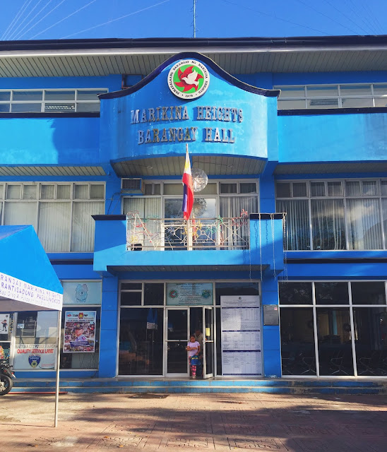
The following pictures were taken during interview and community walk the same day. The places we visited were directed by the same Secretary, Mr. Bernardo. This is the front of the barangay hall of  Marikina Heights. These are the handouts and manuals that are given to the trainees and they contain all the necessary information regarding disaster risk reduction and management and the barangay. This is Utility Truck used to pick up heavy loads and what need be: people, materials, tools, branches, et cetera. This is a Fire Truck that is readily available to respond in the vicinity of the barangay. NOTE: Unfortunately, I was not able to document the boats, life vests and other disaster equipment as they were not present in that area, as they are stored elsewhere.

Environment Check

Image
The following pictures were taken during community walk the same day. The places we visited were directed to us by the same Secretary, Mr. Bernardo. This is East Narra, one of the more open spots in Marikina Heights. This is one of the places people are told to go to in case of earthquakes because of its distance to tall buildings. This is a creek near one of the barangay centers. It was built to built to be higher so that it would be able to keep water inside it instead of overflowing to the streets. The proximity of Marikina Heights is covered with large trees. With that being said, the LGU still makes efforts to cut its branches to a reasonable size so that it won't be prone to falling or breaking. The two pictures above are that of the drainage system in the vicinity. It is maintained and kept clear of any obstructions so that the rainwater would be able to go directly to the sewers. As you can see, only leaves that fell from the trees are seen in ...

Interview with Mr. Bernardo Pagkatawaran

Image
Attached is the recording of the interview with the Barangay Secretary, Mr. Bernardo Pagkatawaran. He was the one who was able to cater to us with regards to the Disaster Risk Reduction and Management of the Barangay. He enumerated several hazards and histories of calamities, the usually affected constituents and the preventive measures done.  Below is the audio recording of the whole interview: